Woodlot adjacent to cornfield in southern Ontario. While some areas, such as this one, are suitable for both agriculture and forestry, many are best left wooded.
Agriculture in New Brunswick < previous | 1 | 2 | 3 | 4 | next>
Potatoes are the primary cash crop in New Brunswick, followed by dairy products, eggs and poultry. Crops account for 48% of farm cash receipts and livestock 49%. Farming areas are dispersed because land with good soils and suitable microclimates is scarce and scattered. Only 20 percent of the landmass of the province is appropriate for agriculture, and currently less than 6 percent is actually being cultivated. During the 20th century, the number of farms in the province declined dramatically as a consequence of industrialization and many rural people left farming for other ways of earning a living. Today small family farms still make up the bulk of the farms that remain, but their numbers are dwindling and thousands of acres of previously cultivated land are returning to forest. Most farms are relatively small, averaging 126 hectares (311 acres).
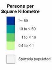
The upper Saint John Valley is the only large region of the province well suited to agriculture. It can be seen on the population map above as the green area between the centrally located blue of Fredericton, and the border with Maine. On the Crown lands map at right this area is mostly white, as it is privately owned. The valley is a major potato-producing area. Down river, near Fredericton and on towards St. John, apples are a common crop.
The other portion of the province that is important agriculturally lies in the east around Moncton. This region is a leading dairy area in the Maritimes, particularly in river valleys near the Bay of Fundy (tributaries of the Petitcodiac near Moncton, and the Saint. John, near St. John). On the population map above this is the green area within the triangle defined by the three blue zones of Fredericton, Moncton, and St. John. Being privately owned this area appears in white on the Crown lands map at right. Field crops, mainly oats and hay cut from cultivated grasses, are grown to support dairy herds in this area. Some farming also occurs on the east coast along the Northumberland Strait, but is often a part-time occupation for fishermen.
Most of New Brunswick's agricultural produce is consumed within the province, except potatoes and some fruits, such as blueberries and strawberries, which are shipped to other Canadian provinces or exported to the United States.
Continued: Forestry in New Brunswick
<
previous | 1 | 2
| 3 | 4 | next>